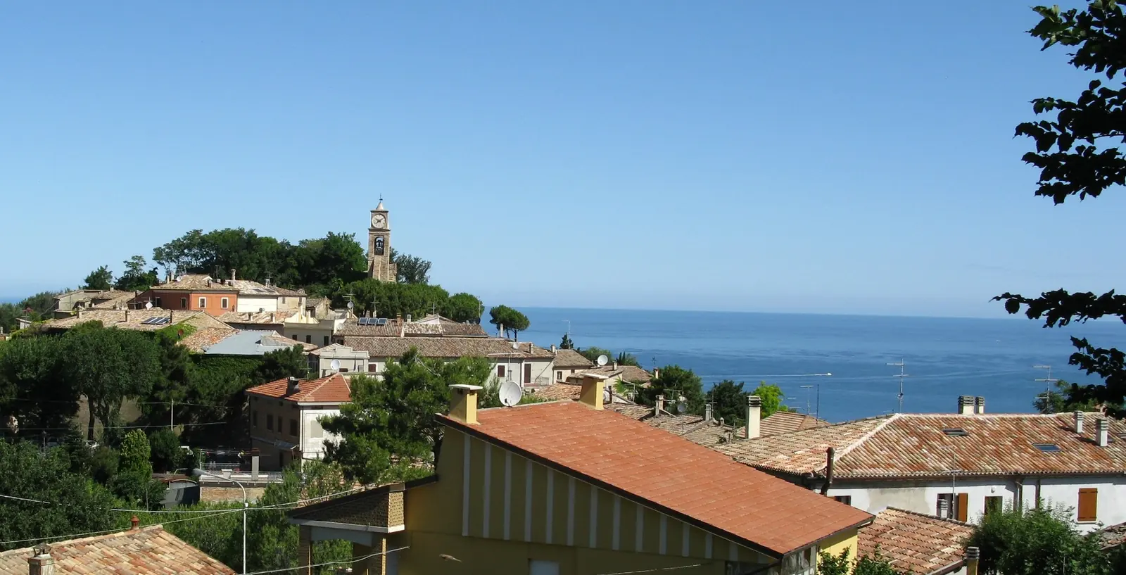
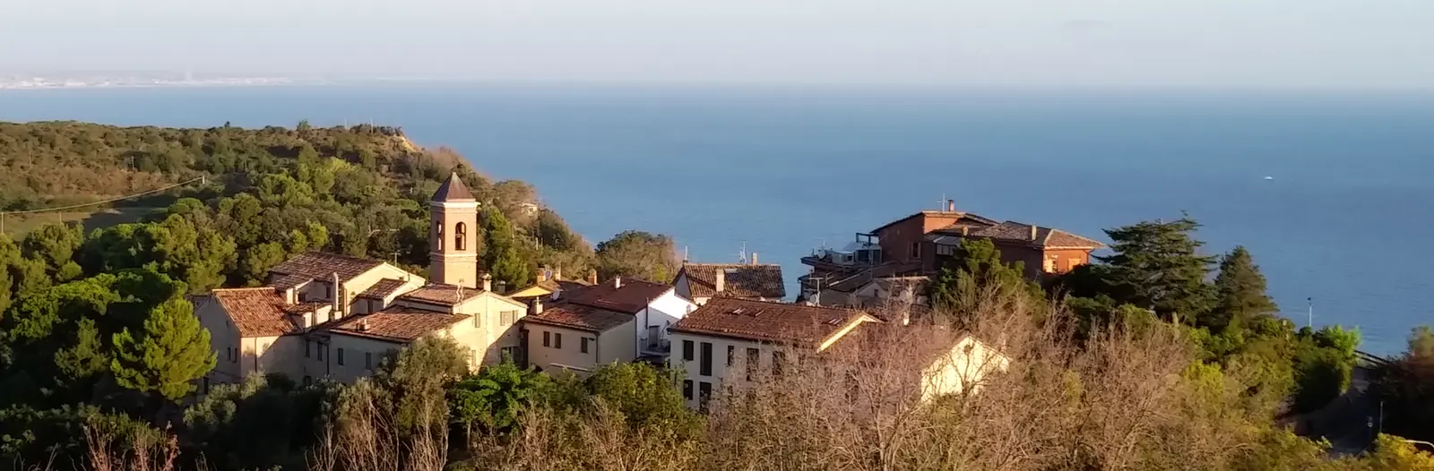
Photo by Toni Pecoraro, Wikimedia Commons, Public domain
Parco del Monte San Bartolo, Pesaro
Fiorenzuola di Focara
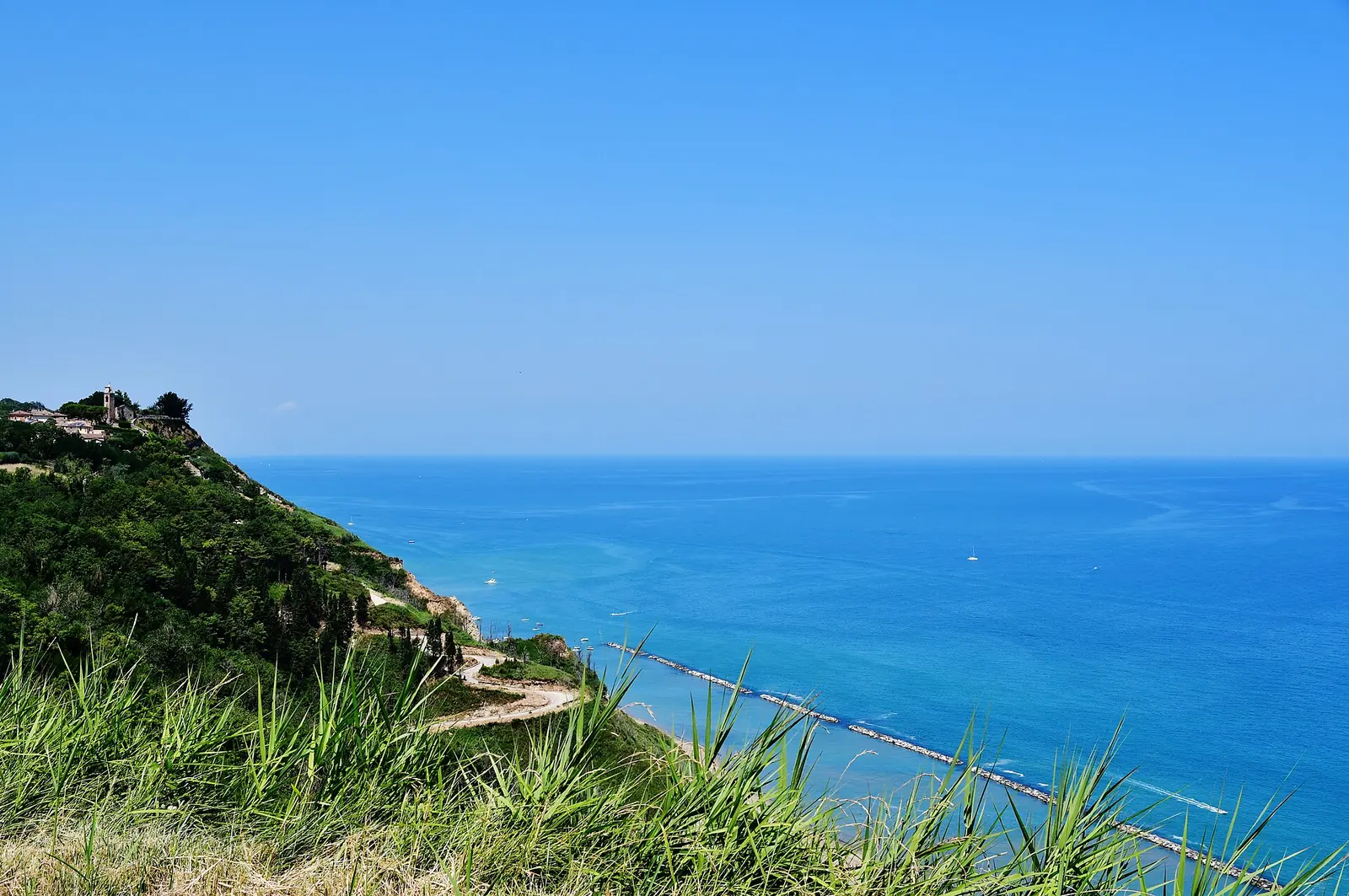
Fiorenzuola di Focara is a medieval village in the Comune di Pesaro, Marche, within Parco naturale regionale del Monte San Bartolo. It stands on a clifftop spur above the Adriatic between Pesaro and Gabicce Mare. From the centre, the free beach is a 10-15-minute walk down a paved road; beneath the cliff, visitors may stay only within a marked stretch of around 250 metres. By bus, Adriabus urban route 14 reaches the village from Pesaro station on weekdays.
The village: ancient Castrum Florentii
The medieval castle, Castrum Florentii, was contested between the Church of Ravenna and the Church of Pesaro, passing definitively to the Comune di Pesaro in the 13th century. With Casteldimezzo, Gradara and Granarola, it was one of four castles built between the 10th and 13th centuries to control the Siligata pass.
For centuries, the village was simply Fiorenzuola. The addition “di Focara” came in 1889. Two explanations are proposed for the name: fires lit on the coast to guide sailors, or kilns for bricks and terracotta.
Repeated earthquakes damaged the village. The entrance gate survives, alongside part of the medieval walls with three of the five bastions of the pentagonal circuit and, from Chiesa di Sant'Andrea, documented since the 12th century, the clock bell tower visible in the header photograph. The village also houses Museo paleontologico “L. Sorbini”.
Focara in Dante's Inferno
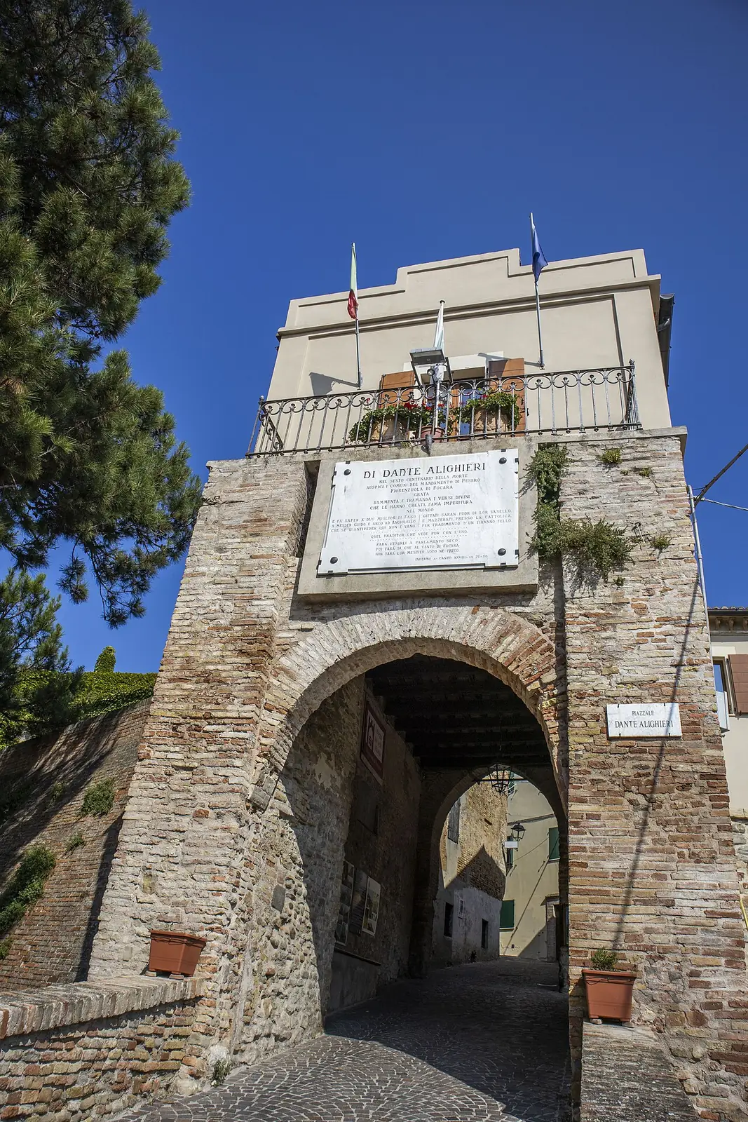
Dante names Focara in canto XXVIII of the Inferno. The headland appears for its wind, feared by sailors, in the prophecy about two citizens of Fano drowned off Cattolica. A plaque above the village gate bears the verses.
The beach: descent and permitted areas
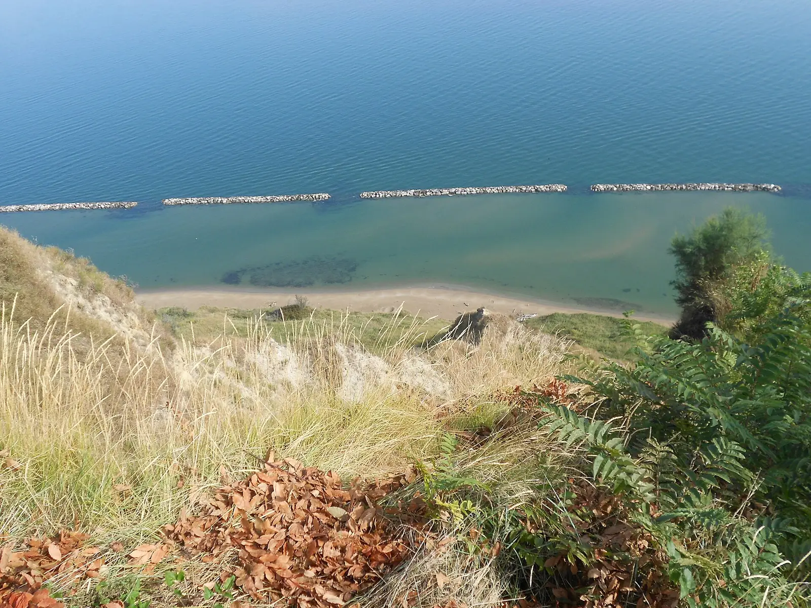
Paved Strada della Marina starts in the village centre and descends to a concrete area on the beach: walking takes 10-15 minutes down, somewhat longer back up. The free beach has sand and “cogoli”, pebbles rounded by the sea.
There is also an official park trail, Itinerario 3 “Dalle Siligate al Mare”. It starts from Statale Adriatica in Siligate, crosses a small wood beside the cliff and reaches the beach: 2.3 kilometres, around 45 minutes.
Beach rules are set by two Comune di Pesaro ordinances and the Capitaneria di porto ordinance.
| Measure | Provisions |
|---|---|
| Comune di Pesaro, ordinance 1103/2010 | Beach open to the public only for 100 m towards Vallugola and 150 m towards Pesaro from the concrete area, at least 15 m from the cliff base |
| Comune di Pesaro, ordinance 1179/2013 | Access prohibited year-round on the remaining coast beneath the cliff, between Sottomonte (Baia Flaminia) and Vallugola |
| Capitaneria di porto di Pesaro, beach safety ordinance no. 14/2026 | Swimming prohibited within 20 m of the shore along the same stretch, except in front of Fiorenzuola beach; climbing breakwaters prohibited |
Current ordinance texts are on the Comune di Pesaro public coastal land regulations page. The 2010 ordinance assigns Ente Parco continuous cliff monitoring, as heavy rain can dislodge material from the face.
Casteldimezzo and park trails
North of Fiorenzuola towards Gabicce stands Casteldimezzo, Castrum Medii, so called because it lay between the Gabicce and Fiorenzuola castles. From the village, around 200 metres above sea level, views reach Castello di Gradara and Monte Catria. Chiesa dei Santi Apollinare e Cristoforo preserves a 15th-century crucifix attributed to Jacobello del Fiore.
Park Itinerario 4 links the Colombarone archaeological area to Museo paleontologico in Fiorenzuola via Casteldimezzo: 4.5 kilometres, around an hour and a half. The Ente Parco villages listing describes other headland villages.
Getting to Fiorenzuola
By car, access is from Statale Adriatica at Siligata, then along Strada Fiorenzuola di Focara, or along Strada Panoramica crossing the park. Since 20 October 2019, the Panoramica has been closed to traffic every Sunday from 6.30am to noon for walkers and cyclists; the road from Siligata remains open.
By bus, Adriabus urban route 14 runs from Pesaro station to Fiorenzuola Centro in around half an hour, weekdays only and with few daily services (winter 2026-2027 timetable). In summer 2026, Comune di Pesaro and Adriabus also ran a free shuttle between Pesaro station, park villages and Gabicce Mare on selected days from late June to early September.
From Gabicce Mare, Fiorenzuola combines with other excursions from Gabicce Mare on the headland, such as Gabicce Monte and Baia di Vallugola.
Sources: Ente Parco naturale regionale del Monte San Bartolo, village and Itinerario 3 and 4 pages; Regione Marche, letsmarche.it portal; Comune di Pesaro, ordinances 1103/2010 and 1179/2013, “Navette estive 2026” and “Camminare nel San Bartolo” pages; Capitaneria di porto di Pesaro, beach safety ordinance no. 14/2026; Adriabus, Pesaro urban timetable 2026-2027; accessed on 10 October 2026.