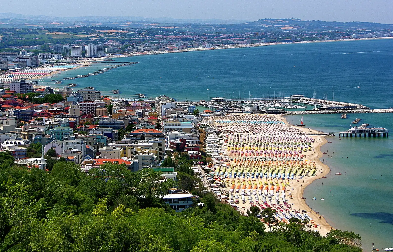
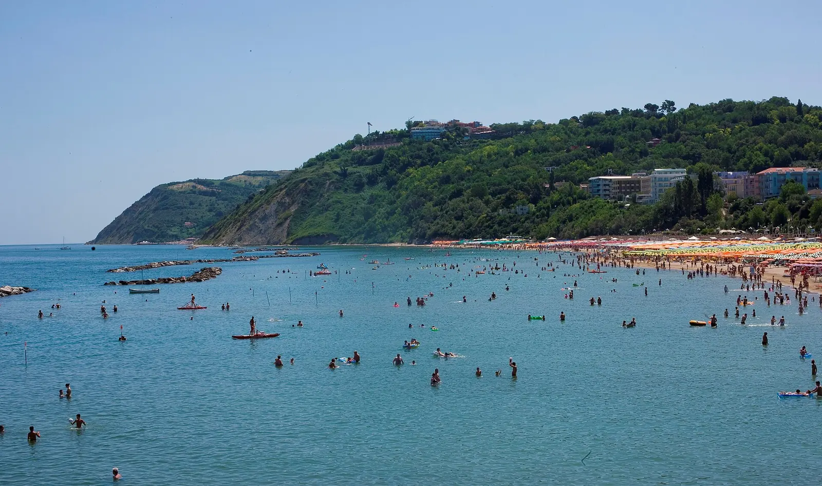
Gabicce Mare's town beach occupies the bay between the harbour on the Tavollo and the Gabicce Monte headland. It is mainly sandy, with beach establishments and free stretches facing a sea protected by breakwaters. Further south, the coast changes: cliffs interrupt the continuous beach, and Vallugola bay has a stony beach.
Harbour, centre and Sottomonte
The Tavollo marks the boundary with Cattolica and separates two regions. Gabicce Mare is in the Marche, with its own calendar: the 2026 bathing season ran from 1 May to 20 September.
| Stretch | Landmarks | Landscape |
|---|---|---|
| Harbour | pier on the Tavollo and first beach establishments | town beach near the Cattolica boundary |
| Central section | Lungomare Cristoforo Colombo | beach establishments and sand facing the breakwaters |
| Sottomonte | Viale Mare and southern part of the bay | beach below the slope of Gabicce Monte |
| Cliff coast | headland towards Vallugola | cliffs with closed stretches and no continuous shoreline walk |
| Vallugola | bay and small harbour | stony beach in Parco del Monte San Bartolo |
Beach establishments are numbered from 1 beside the harbour to 46 in Vallugola, with some numbers combined. Position relative to the harbour and the descent from Viale Mare remains the practical landmark for access.
Sand, seabed and breakwaters
ARPAM listings describe a sandy seabed sloping gently into the town bay. Emerged breakwaters enclose a partially sheltered stretch of water.
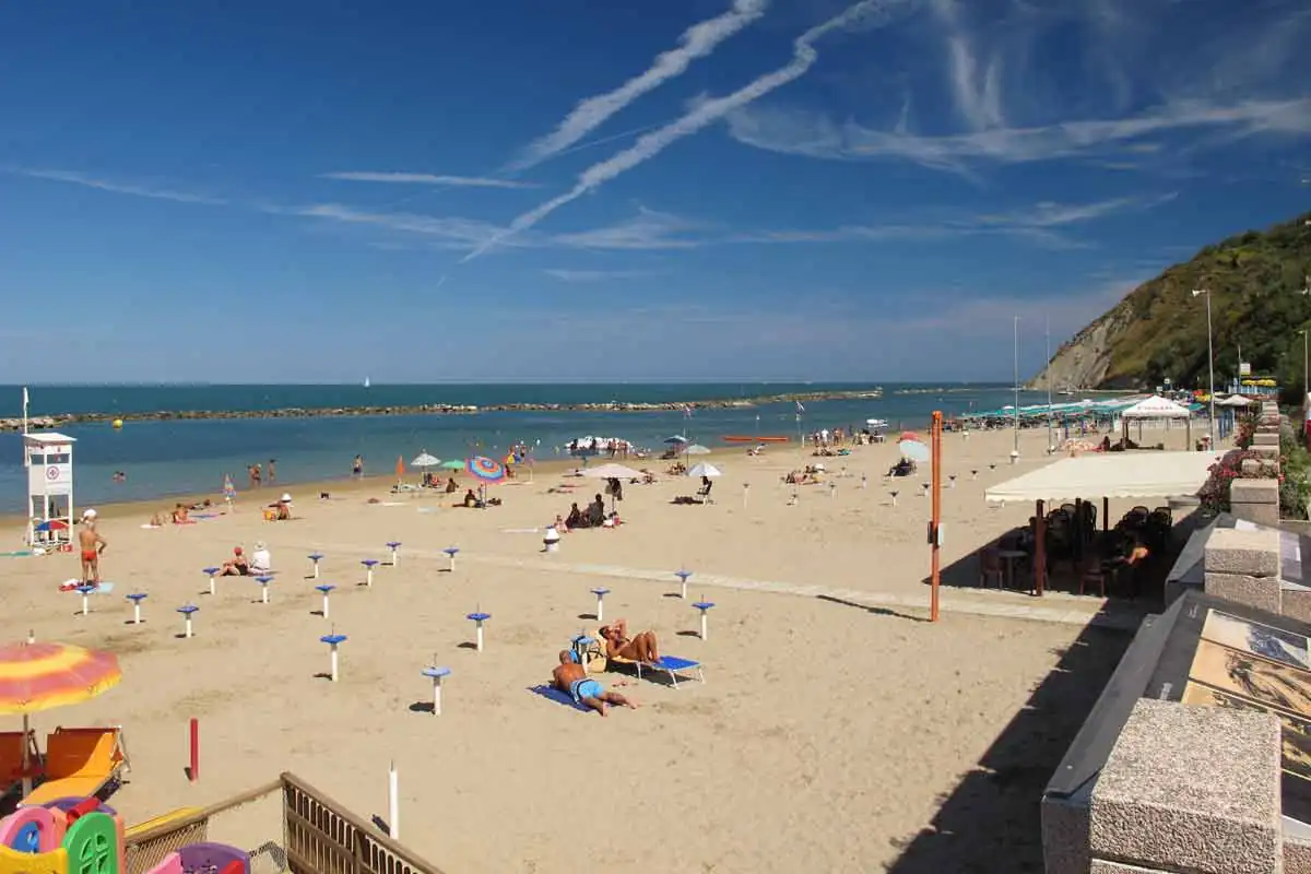
The coast does not keep the same shape over time. Comune documents distinguish stretches where sand accumulates from those subject to erosion, particularly towards the east; sand movements and coastal defences alter the beach from season to season.
Off Sottomonte, environmental listings record submerged marine vegetation, including Zostera and Cymodocea. This is part of the coastal ecosystem, distinct from beach services.
Access from the lower seafront and Viale Mare
Via Cristoforo Colombo follows the town beach at the lower level. Viale Mare runs higher up; the public lift connection joins the two seafront levels but does not reach the village of Gabicce Monte. The descent from Viale Mare is the landmark for Sottomonte.
ARPAM listings specify accessible services and a route to the sea at the bay's beach establishments. Other travel information is in the Gabicce Mare guide.
Beach establishments, free areas and dogs
Beach establishments offer organised beach spaces and services along the bay. Porto, Sottomonte and Fortino are the landmarks for Gabicce Mare's free beaches.
Marche rules apply to dogs: the regional coastal regulation excludes them from beaches from 1 April to 30 September, except guide dogs and certified water-rescue dogs; outside that period, there is no regional ban. On Parco del Monte San Bartolo beaches, below the cliffs and in Vallugola, park regulations prohibit dogs in every month, except service dogs, rescue dogs and dogs accompanying people with visual impairments.
Vallugola: the bay below San Bartolo
Vallugola is an inlet between the Gabicce and Casteldimezzo headlands, in Parco del Monte San Bartolo, about five kilometres from central Gabicce Mare. Its stony beach corresponds to beach establishment 46, which has an accessible route to the sea and accessible services. Beside it is the marina, where swimming is prohibited.
Getting there
By car, the route climbs to Gabicce Monte and continues on Strada Panoramica, from which Strada della Vallugola descends to the bay. On foot, park path 151d leads from Panoramica to the harbour: 937 metres, about 10 minutes downhill and 15 uphill. There is no shoreline route from the town beach: below the cliffs as far as Vallugola harbour, passage along the coast and all sea activities within 50 metres of the waterline are prohibited because of landslide risk.
Park rules
Park beaches can be reached only on foot, using public roads, the path network and permitted access points. Fires and barbecues, picking plants and, from 8pm to 6am, noise and strong artificial lighting are prohibited. The headland's landscape and routes are covered in excursions from Gabicce Mare.
Continuing towards Pesaro, Fiorenzuola di Focara is a park village with a footpath down to a small rounded-stone beach: access and restrictions are on the Fiorenzuola di Focara beach page.
Water quality
Gabicce Mare's six bathing waters are classified as excellent for 2026. During the season, sample results and any temporary bans are published on the ARPAM bathing water portal.
Sources: Comune di Gabicce Mare, territorial data, accessed on 29 September 2026; Pesaro bathing safety ordinance 14/2026, accessed on 8 October 2026; ARPAM, 2026 bathing water listings, and Ministero della Salute, Portale Acque; Ente Parco del Monte San Bartolo, “Spiagge” page, 2026 path map and regulations, articles 85 and 93; Regione Marche, regional coastal regulation 2/2004 and “Baia Marina di Vallugola” tourism portal listing; accessed on 10 October 2026.